Project
Alberto Peña Kay
Protecting the Santurban páramo from mining's damage
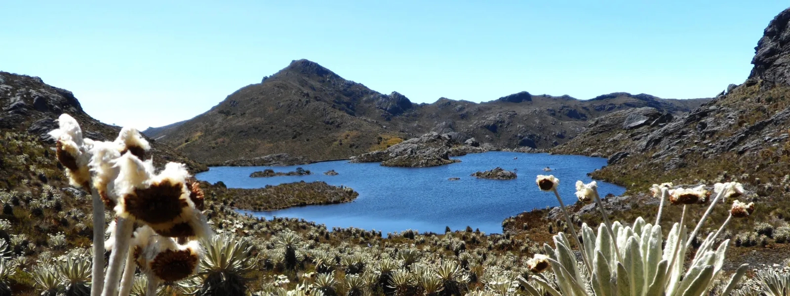
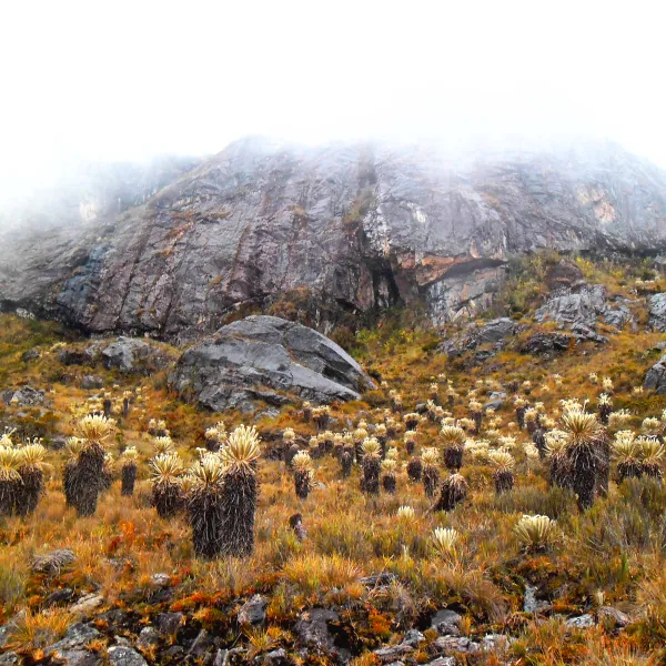
In the Andean region, high-mountain ecosystems known as páramos capture water from the fog and supply it to the lowlands. One such ecosystem is the Santurbán páramo, which provides fresh water to more than two million people in Colombia.
Santurbán, like the other páramos on the continent, also captures large amounts of carbon, making it a key ally in mitigating the climate crisis. It is also a refuge for hundreds of endangered species, including the iconic spectacled bear.
The land in and around the páramo contains gold and other minerals. This has put Santurbán in the spotlight of the multinational mining industry, which for decades has sought to establish large-scale projects in the ecosystem that threaten to degrade it.
The Committee for the Defense of Water and the Santurbán Páramo—a coalition of environmental advocates—has thwarted these ongoing attempts, with support from AIDA and other civil society organizations.
Background
The Santurbán páramo is located in the heart of the Eastern Cordillera of the Colombian Andes, in the departments of Santander and Norte de Santander, at an elevation ranging from 2,200 to 4,290 meters above sea level.
It covers an area of 129,743 hectares and is home to 57 lakes. It serves as a habitat for 457 plant species and 293 species of vertebrate fauna.
There are mineral deposits in Santurbán, primarily gold, but also silver and copper. This explains the region’s mining tradition, particularly in the part of the páramo located in Santander, in the province of Soto Norte. The communities in the area have built their culture and identity around gold mining, which is mainly artisanal and small-scale.
But since the 1990s, the gold deposits in the páramo have also attracted foreign mining conglomerates seeking to develop large-scale projects. This has raised concerns among the population that relies on the Santurbán water sources, who have mobilized in defense of water, their land, and life.
Although national and international regulations prohibit mining in páramos, the Colombian government has granted mining concessions to transnational corporations in Santurbán.
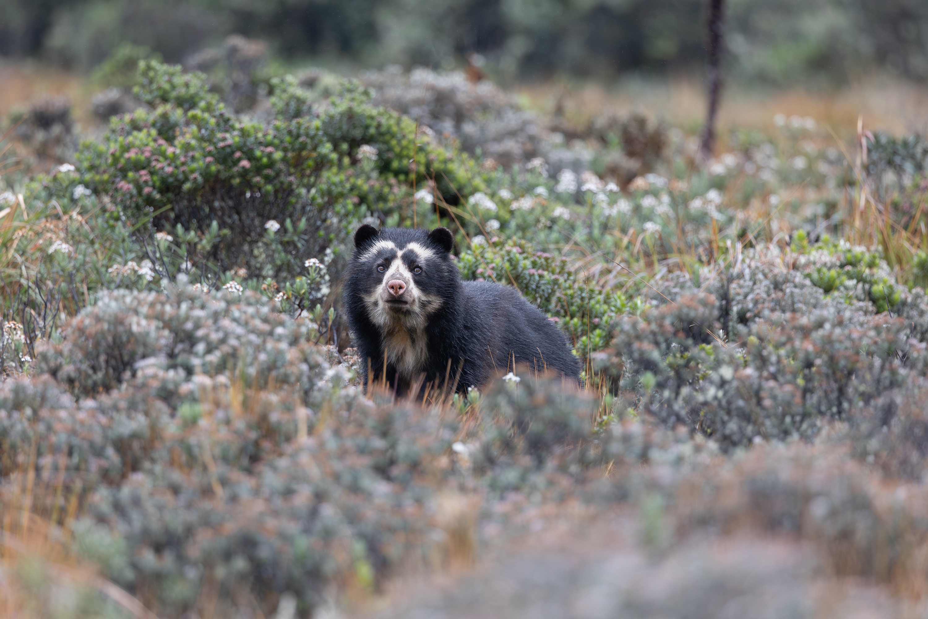
Photo: Keishpixl / Pixabay.
The long struggle to protect the páramo
One of the companies that sought to develop large-scale mining in Santurbán is Eco Oro Minerals Corp.—formerly Greystar Resources—a Canadian company that intended to establish the Angostura open-pit mine there to extract gold and silver. Between 1994 and 1995, the company acquired its mining titles and conducted exploration. And in 2010, it applied for a mining permit.
That was the year AIDA became involved in defending the ecosystem, supporting the Committee for the Defense of Water and the Santurbán Páramo. Our legal work helped convince the Colombian government to deny the mine an environmental permit in May 2011.
In January 2013, the government designated a portion of the páramo (11,700 hectares) as a Regional Natural Park. That year—together with the committee and partner organizations—we carried out a campaign and advocacy efforts to urge the government to recognize the entire Santurbán area as a páramo ecosystem through a delimitation based on scientific criteria. In December 2014, the Ministry of the Environment established a delimitation that protected 76% of the páramo (98,954 hectares).
Furthermore, as a result of a litigation supported by AIDA, in February 2016, Colombia’s highest court reaffirmed that mining in páramos is prohibited.
That same year, in December, the International Finance Corporation (IFC), the World Bank Group’s private sector arm, decided to divest from Eco Oro Minerals. This achievement was the result of a process that began in 2012, when the committee—advised and supported by AIDA and international partner organizations—filed a complaint before an independent accountability mechanism, which concluded that the IFC’s investment in the Angostura project failed to take into account the project’s social and environmental impacts, thereby contradicting the financial institution’s internal policies.
Also in 2016, Eco Oro Minerals filed an arbitration claim against the Colombian government with the International Centre for Settlement of Investment Disputes (ICSID), arguing that it had been adversely affected by government decisions aimed at protecting the country’s páramos, including the delimitation of Santurbán.
In 2017, the Constitutional Court invalidated the delimitation because the affected communities were not consulted. The high court ordered that a participatory delimitation be carried out.
And that year, a new threat to Santurbán emerged when the Canadian multinational Aris Mining applied for an environmental permit for Soto Norte, a gold mining project located near the páramo. Following citizen protests and technical objections, in October 2020, the National Environmental Licensing Authority shelved the project.
Photo: Aztlec.
Current situation
In March 2025, the Colombian government designated the western flank of the Santurbán massif as a temporary renewable natural resource reserve area, delimiting and protecting an area of 75,344.65 hectares. This resulted in a two-year suspension of the Soto Norte project. However, Aris Mining's contract to formalize Calimineros' small-scale mining activities through the purchase and processing of mineralized material remains in effect.
In addition, the Canadian mining company continues to move the project forward. In September 2025, it released its prefeasibility study, revising the mine’s original design.
Meanwhile, members of the Committee for the Defense of Water and the Santurbán Páramo face threats and stigmatization because of their work. In March 2025, UN Special Rapporteurs and the Working Group on Business and Human Rights denounced these incidents in communications sent to the governments of Colombia, Canada, and the United Arab Emirates, as well as to the companies Aris Mining and MDC Industry Holding Company LLC, the former co-owner of the Soto Norte project.
Regarding the arbitration claim filed by Eco Oro Minerals, in July 2024, ICSID ruled in favor of the Colombian government and rejected the Canadian company’s claim for USD 1.1 billion in compensation.
Concerning the delimitation of Santurbán, in July 2026, the Ministry of the Environment issued a resolution introducing the concept of "progressive delimitation." On that basis, the government proposes to progressively demarcate the páramo, covering 29,199 hectares across 19 municipalities—those where the participatory agreements required by the Constitutional Court in its 2017 ruling have already been finalized. It also proposes two measures on the creation and expansion of reserves to restrict mining in the ecosystem.
Learn more about the impacts of mining on the páramos of Latin America (in Spanish).
Partners:
Related projects
The hidden mine that threatens Colombia’s water
For me, a living thing like water can never be replaced by a non-living thing like gold. Gold should never be worth more than the water that gives us life. While those who defend mining often argue for it by saying that all human activity causes impacts, that line of thinking fails to address the underlying problem. When will we start recycling instead of extracting new resources? When will we stop assigning value to something as scarce but futile as gold? When will we treat the natural environments on which we depend with the respect they deserve? Taking these questions into account is critical not just for Colombia, my home, but also for all Latin American nations. In September I learned of the latest threat to one of our most important natural ecosystems, the Santurbán páramo. For centuries it has stood high in the Andes, keeping watch over the water of millions of us Colombians. For the last decade, mining companies have overlooked its ecological importance and angled to exploit the páramo’s lands for mineral wealth. For years, we’ve worked successfully to stop them. Now an international corporation has submitted the Environmental Impact Assessment for a new underground mining venture there. Located in the municipalities of Suratá and California, in northern Colombia, the mine would involve an intricate system of tunnels at least 2,000 meters long, 900 meters wide and 780 meters deep (only slightly shorter than the tallest building in the world, in Dubai). It would be built in two sections—traversing two river basins and two different municipalities—united by two immense 5,800-meter tunnels (nearly the expanse of the Colombian city of Bucaramanga from north to south). Previous attempts at mining near Santurbán have been rejected due to the potential damage they would cause to this unique natural environment, which serves as a key water source, a carbon sink, and shelters many endemic species of plants and animals. The risks of the project, examined The Company claims the new project will be different—no permanent accumulation of debris, no hazardous substances, no toxic sludge, and no mass infrastructure development. If this sounds too good to be true, that’s because it probably is. Could their venture really be different than the mega-mines that came before, or is it just dressed up that way? Let’s see: The company says the project’s only dump will be located near the mine and the waste will be dry. But dry waste in one site would require perpetual maintenance of the drainage network and other factors that, after the mine closes, it’s likely neither the company nor the State will be able to control. They say the project’s design would involve retro-filling all mining tunnels. But the impacts of drilling on the direction and volume of groundwater are unpredictable. It would be impossible to guarantee that the quality and quantity of water in the subsoil is conserved. They say that because the mine is technically outside the Santurbán páramo, it won’t affect the sensitive ecosystem. But technicalities aside, the mine would be only tens of meters below the páramo. Because it is an underground mine located in crystalline rocks, drilling could cross the multiple fractures through which water is transported to rivers, ravines and soils. They say the project will not use mercury or cyanide to obtain gold and other metals. By selling and exporting those metals to other companies in the form of ready-to-process concentrates, the company hopes to lessen the socio-ecological cost of the activity. But while it’s true Colombia may be spared the negative effects of toxic chemicals, that cost might be transferred to other countries, where the processing will take place. As Colombians we must begin to acknowledge the external impacts of our extractive industries, and stop ignoring our nation’s ecological footprint. The responsibility for the damages caused outside our borders by the mining that is done in Colombia is not only that of the buyer, but also of the Colombian State. Large-scale damages It’s important to understand that a hidden mine is not necessarily a better mine. What is done under the ground, especially on such a large scale, can do extensive damage to a much wider area. It’s a reality we must be keenly aware of in one of the most biodiverse countries in the world. We must think about the impact the mine would have on the quality and quantity of groundwater in the area, and the risks we’re taking by not having an adequate buffer zone for the páramo. Hiding the trash under the carpet does not mean you’ve cleaned, not in terms of the economy and certainly not in terms of mining. The protection of Santurbán, and that of other freshwater sources in Latin America, is one of the pillars of AIDA’s work. We’re proud to continue standing alongside our allies in Colombia and fighting to maintain the health of Santurbán.
Read more
5 ways our governments can confront climate change
As individuals, we know about the small actions we can take to help reduce the emissions that cause climate change. But what can and should our governments do, seeing as their large-scale actions are fundamental to the welfare of their people? Earth, we have a problem: we’re essentially melting. High rates of greenhouse gas emissions, paired with environmental degradation and the overexploitation of natural resources, have us in a race against time. Ninety-seven percent of scientists agree that climate change is a result of human activities. And if we fail to stop global warming soon, the changes will be catastrophic. Each year, at the United Nations climate conference, global leaders meet to discuss actions we can take to help prevent, and be better prepared for, climate change. At COP21 the first binding global climate accord, the Paris Agreement, was born. This year, during COP23, delegates seek to establish rules to allow for its proper implementation. As individuals, most of us understand what we can do to reduce emissions: save energy, use the car less, recycle more, make better consumption choices, and engage in family planning. But what can our governments do? To discuss their contribution is to talk about large-scale measures that are vital to ensuring a better future for all. 1. Protect and restore key ecosystems Respect for nature is fundamental. Governments must protect ecosystems key to the fight against climate change: rivers, wetlands, oceans, forests and mangroves absorb large quantities of carbon, slowing warming. Mangroves also serve as a barrier against tropical storms, and wetlands absorb excess water from floods, both extreme weather events exacerbated by climate change. “Healing the natural system is the most feasible, realistic and fair option, since it would benefit humanity and all species,” said Florencia Ortúzar, an attorney with AIDA’s Climate Change Program. “In terms of conservation and restoration, we’re in a race against time, and we’re already beginning to witness alarming natural phenomena, like forests so degraded they’re losing their ability to absorb carbon.” 2. Support small agricultural producers According to the FAO, the meat industry is responsible for 15 to 18 percent of all greenhouse gas emissions, exceeding even those of the transportation sector. In addition, it is the most significant source of water use and contamination in the world. Today, 80 percent of all agricultural production goes toward feeding animals not people. The expansion of land for livestock, and the crops to feed them, is the most significant cause of deforestation in the Amazon. Governments can make a difference by supporting small local producers who, unlike large factory farms, employ sustainable practices, care about land restoration, benefit nearby communities, and make animals and crops more resilient to climate change. It’s less about everybody becoming vegetarians, but more about supporting those who produce our food with a respect for nature. 3. Promote green energy Thirty-five percent of all global emissions come from energy production. But as countries bet on more development, they’re also betting on more energy production. But as countries bet on more development, they’re also betting on more energy. While thermoelectric and hydroelectric energies were long considered the cheapest options, technological developments have allowed us to find better, cheaper, more efficient alternatives. With proper long-term planning, nations can avoid old climate-aggravating energy sources (hydropower is not green) and opt for small wind, solar, geothermal, oceanic and other projects that adapt to a place’s unique characteristics. “When thinking about energy, it’s best to bet on a diversified matrix, prioritizing projects that are close to places where people need energy, saving on losses and infrastructure,” Ortúzar explained. “We must give absolute priority to the protection of nature. Every action, public policy, or strategy should be analyzed with nature in mind, and the production of energy is a good starting point.” 4. Combat short-lived climate pollutants Carbon dioxide (CO2) is the most infamous greenhouse gas. Since it remains in the atmosphere for centuries (even millennia), even if we stopped all its emissions sources today, the effects of climate change would continue. The good news is that other contaminants exist that contribute to climate change and only last a few days or years in the atmosphere. They’re known as short-lived climate pollutants, and they’re responsible for 30 to 45 percent of the emissions that cause global warming. These pollutants include black carbon (soot), methane, ozone, and the hydro fluorocarbons found in refrigerants. Their effective control, through national policies and regulations, could accelerate the fight against climate change in the short term. In addition, because they cause serious air pollution, measures to mitigate them would directly benefit human health. 5. Bet on adaptation, not just mitigation In the fight against climate change, work aimed at reducing emissions, stopping their effects and diminishing future consequences is known as mitigation. It is important. However, some communities are already experiencing tragic consequences due to changes in climate over a short period of time. So we also must act to prevent catastrophes, increase resilience, and reduce vulnerability, which is known as adaptation. Projects to mitigate emissions are more attractive financially than those designed for adaptation, which are generally focused on the most vulnerable communities. But it is important to give adaptation the significance it deserves in recognition of the fact that the impacts of climate change are already a grave reality for many. At this year’s COP, representatives are discussing a “loss and damage” mechanism, referring to the compensation that developed countries – the main causes of climate change – must make to developing countries, which suffer significant losses due to adverse climate effects, Ortúzar explained. Our governments must support these discussions and commit to the effective use of resources, so all the world’s people can be better prepared for, and help to prevent, greater changes to our climate.
Read more
Honoring the indigenous connection to the San Pedro Mezquital River
In Northwest Mexico, the Western Sierra Madre Mountains rise like giants from the coastal wetlands of the Gulf of California to the Central Mexican Plateau. Indigenous communities have long found shelter in these isolated lands, and the space to maintain their culture and way of life. The region’s last free-flowing river cuts smoothly through the mountains, carving out fertile valleys, carrying fresh water and life downstream to the wetlands of Marismas Nacionales. The Nayeri and Wixárika people venerate the San Pedro Mezquital River. It brings life to their lands, and many of their sacred sites are dotted along its winding path. Despite its importance, the river—and with it the rights of more than 15,000 indigenous peoples—are at risk from the proposed Las Cruces hydroelectric dam. The dam’s reservoir would flood 14 sacred ceremonial sites, and threaten their culture and way of life. I was honored to walk alongside the Nayeri and Wixárika people last May, and participate in a joint ceremony intended to show their commitment to defending their rights in the face of this government-sponsored megaproject. It’s a commitment that was recently and formally manifested again, when representatives presented their case before the United Nation’s Special Rapporteur on the rights of indigenous peoples. The images I captured of that pilgrimage are a testament to the beauty and strength of the living indigenous cultures of the Western Sierra Madre. We left from the town of Rosamorada in Nayarit State on a pilgrimage to Keiyatsita, a ceremonial site along the San Pedro Mezquital River. We walked single file, winding up into the mountains and then down, again, to the river’s edge. When we arrived to the river, we performed a ritual, and were marked with ashes and creole corn flour to protect us on the journey. Walking beside so many indigenous people, of all ages—mothers and fathers, children and elders—was an enriching and inspiring experience. This particular pilgrimage was historic, as it brought together two different indigenous communities—the Náyeri and the Wixárika—to honor the sacred spaces they share. In a joint declaration, they wrote that, beyond the spiritual reasons for the ceremony, they came together: "to unite against the hydroelectric project Las Cruces and thus show the Mexican government that we are not alone and we are not isolated… After this historic ceremony, both indigenous groups will further strengthen our cultural, spiritual, political and legal struggle and defense against the aforementioned dam, as well as strengthen our ties with other indigenous peoples of Mexico and the world.” They walked to honor the river, to nurture the earth, and to demonstrate their commitment to protecting their sacred spaces. Both indigenous groups see themselves as the guardians of these sites—places like Keiyatsita that provide them with the knowledge and wisdom of how to care for their mother earth. These sites are vital not just to their historical memory, but to their culture and identity. The ceremony at Keiyatsita began in the afternoon. Through prayer, song and dance they expressed their devotion to their native corn gods, Tatei Niwetsika, or mother Maíz, in her five colors—yellow, blue, pink, white and red. In the middle of the night, the animals that walked beside us through the mountains were offered up to the gods amidst the river’s running water. The prayers, songs and ceremony lasted all through the night. These sacred sites along the San Pedro Mezquital river are living spaces, and part of what makes Mexico so rich. They are a reflection of the indigenous cultures and traditions that remain very much alive in the Western Sierra Madre Mountains. They are places that, because of their cultural and spiritual importance, must be honored and protected as part of our international heritage. Indigenous peoples are the best guardians of our planet. And now, they are called on again to protect this unique and precious place—the last free-flowing river in Northwest Mexico and the lands it travels through, from the peaks of Durango to the mangroves of Nayarit along the Gulf of California. Representatives of the indigenous communities of Nayarit stood this week before Victoria Tauli-Corpuz, the United Nationals Special Rapporteur on the rights of indigenous peoples, and voiced their opposition to the dam that threatens their territory and way of life. They explained that they have not given, and will not give, their consent for the advancement of a project that would destroy their sacred sites and the river that provides them with life. Learn more about our fight to protect the San Pedro Mezquital
Read more